Mobile25 is a mapping application. It was meant to be used on our
geocaching trips. The maps are
stored as compressed bitmaps on memory card and e.g. the 1:100.000
(TOP100) and 1:25.000 (TOP25) maps of Baden-Württemberg, Germany
together require about 700MB of memory card space.
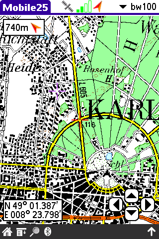
A hirez 1:100.000 map
of Karlsruhe, Germany ...
|
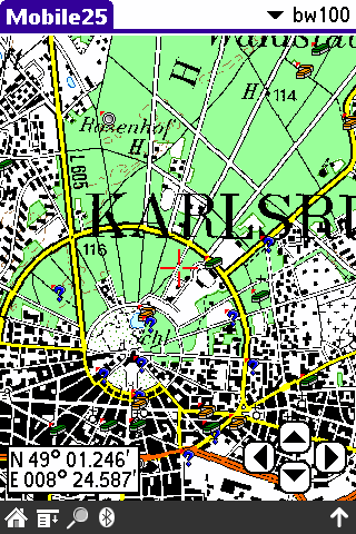
... and with geocaches
imported from a GPX file.
|
Mobile25 supports bluetooth GPS devices and can display the current
GPS position on the map.
A simple waypoint system allows to setup and maintain a list of
waypoints. Waypoints can be highlighted on the map and the distance
and direction from the current GPS position will be shown. Waypoints
are displayed in longitude/latitide format as well as in UTM format.
The latest version supports the inclusion of GPX (geocaching)
waypoints. To use this feature simply place the GPX files under
/PALM/Mobile25/gpx/ on your memory card. You can then
import these files into Mobile25 using the menu.
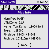
bw25n map details
|
|
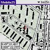
Lorez view on Palm M505
|
|
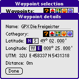
Waypoint edit dialog
|
|
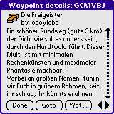
GPX details
|
|
In theory you can convert any digital map in UTM format for use with
Mobile25. You just need a converter tool.
Currently only the top25 maps used in german are supported by a
converter tool. This tool has only been tested with a few maps (see
section below). It is solely based on file format information
available in the
internet and is
provided as is without any guarantee and for private use only.
| Download the latest version |
- V1.0
- Initial release
- V1.1
- Support for waypoints
- V1.2
- GPS and improved hirez support
- V1.3
- Improved GPS and waypoint handling
- V1.4
- Bugfixes and improved waypoint support and screen handling.
- V1.5
- GPX waypoint import
|